
Sanford Previous Residents by Era
Sanford address history is assembled from sources that answer different questions. The Lee County tax card establishes the present parcel, situs, legal description, and assessor owner field. The Register of Deeds supplies recorded conveyances. Hill's directories add printed household and street-guide evidence for selected years. Sanborn sheets and Historic Preservation Office material describe a building and its setting, not a guaranteed list of people. The Register of Deeds online application's earliest coverage was not located in the official research, so older work must allow for the office, physical books, and archives.
| Sanford source | Documented period | Where to consult | Useful address fact |
|---|---|---|---|
| Tax card and property record | Current cycle and available prior tax years | Lee County Tax Assessor | Parcel ID, situs, legal description, tax-year owner field |
| Deed books and index | Online cutoff not located; older history extends beyond the modern portal | Lee County Register of Deeds and archival series | Grantor, grantee, instrument, book/page, dates, legal description |
| Hill's Sanford directories | Selected years from 1950 through 1978 | Lee County Library and DigitalNC | Printed household, street order, telephone, and some owner-occupant clues |
| Sanborn maps | 1908, 1915, 1925, 1930, and 1938 cited locally | LOC, State Archives, and HPO files | Building footprint, use, materials, and street context |
| HPO surveys and newspapers | East Sanford core 1894 to 1960; newspaper runs vary | City/HPO records and NC Archives repositories | Source citations, building history, notices, and event context |
Use the dated tax or deed record when the question is legal ownership. Use the directory and map layer when the question is who may have been associated with a specific address in a specific year. No single row proves every part of a household history.
Note: Record the source date beside each finding because Sanford address evidence can be current, historical, legal, or postal in purpose.
Past Residents Start With a Sanford Parcel
Before searching for past residents, use the Lee County Tax Assessor Property Search and the Lee County GIS Parcel Map to pin down the present address. The assessor accepts parcel ID, owner, legal-description fields, lot number, address number, street, book, page, and tax year. Its owner search uses the form LastName, FirstName, and an asterisk can serve as a wildcard. Copy the parcel ID and legal description exactly, then compare the parcel outline with the street and municipal layers.
A situs address is the land's physical location. A mailing address can belong to a lender, estate, fiduciary, or another recipient. The assessor owner field is a tax-roll label, not a promise that the listed party is the newest grantee or an occupant. That distinction prevents a current parcel result from being mistaken for a list of previous residents.
- Parcel
- A defined piece of land in the tax and GIS systems, usually identified by a county parcel ID.
- Situs address
- The physical address assigned to the parcel, which can differ from an owner's mailing address.
- Legal description
- The lot, subdivision, metes-and-bounds, or other land description used to follow property when street numbering changes.
Past Sanford Residents in Deeds
The deed chain begins with a current parcel and moves from instrument to earlier instrument. A grantor is the party conveying an interest; a grantee is the party receiving it. Copy the book and page, execution and recording dates, legal description, instrument type, and any reference to a prior deed, plat, estate file, or foreclosure record. The county's current portal is the right first stop, but the research did not establish an official online cutoff or stable result-field list. Do not invent either one when a search stops.
The Lee County Register of Deeds public landing page is the official starting point for the live application. Its captured screen is shown below. When an earlier instrument is outside the online results, verify the next route with the office, then use physical indexes, deed books, or State Archives series as appropriate.
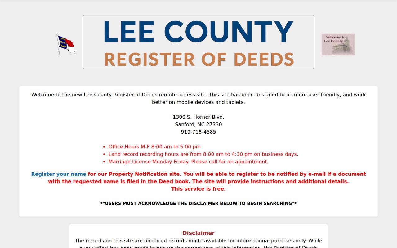
The application image confirms the official access route, not an earliest searchable year or a fixed list of fields. Preserve the live search date with any deed-chain notes.
- Find the present parcel in the assessor and GIS tools. Save the legal description and any available book/page reference.
- Locate the current recorded instrument at the Register of Deeds. Note each party's role instead of calling both parties owners.
- Read the prior-instrument reference and search the earlier grantee, legal description, subdivision, lot, or book/page as the portal allows.
- Compare the legal description at every turn. If it changes, obtain the cited plat before treating two street addresses as the same parcel.
- Stop and change custodians when the record points to another county, an estate or trust file, a corporate record, or an unreadable scan.
- Chain of title
- A chronological sequence of instruments that transfers or affects an interest in the same land.
- Grantor / grantee
- The party transferring an interest and the party receiving it, respectively; neither label alone proves occupancy.
- Plat
- A recorded map of lots, boundaries, easements, or rights of way that can explain a later split or merger.
Sanford Previous Residents: Owner or Occupant?
A property history has two parallel trails. The deed trail identifies legal transactions. The household trail identifies people printed at an address or otherwise associated with it at a point in time. A grantee may have held title without residing at the parcel. A directory entry can lag a move, and the tax owner may be a trust or estate. For a careful statement that someone lived at an address, pair at least two independent sources and keep the year in the wording.
The Hill's 1950 directory used an O notation that may suggest owner occupancy. It is a helpful clue, not a substitute for a deed. The 1962 directory's alphabetical pages list residents, businesses, and institutions, while the householder section provides street and numerical locations. Those printed categories should remain visible in notes instead of being collapsed into one modern claim.
Current address-keyed records are handled in more detail in the Sanford Street Directory. Here, the useful question is narrower: which dated source links a person or household to this historical address?
Sanford Past Residents in Directories
Lee County Libraries and DigitalNC provide the working historical shelf for Sanford past residents. The documented Hill's run includes selected years from 1950 through 1978, with gaps. Start in the alphabetical section when a name is known, then reverse the direction in the street guide using the address and number. The guide can reveal a printed household or business at that location for that directory year. The Sanford Directory Book explains the collection and entry conventions in greater depth.
Pair directory years with the right historical timeframe rather than forcing a modern address into an undated result. A Census schedule can help with a household, but street numbers, district boundaries, and record availability need independent checking. For the local sequence, use this flow:
- Normalize the current number, street name, suffix, direction, and historic labels such as Jonesboro or Jonesboro Heights.
- Choose the nearest Hill's directory year and search both the alphabetical and street-guide sections.
- Record the printed name, address form, telephone, notation, and year without turning a snapshot into a current claim.
- Match the year to a census-era source only after confirming the street or legal parcel context.
- Compare the next available directory year, then return to deeds, tax records, permits, or newspapers for any unexplained change.
Note: The documented directory series is selected-year coverage, so an absent name may reflect a gap, indexing choice, or an address change.
Past Residents and Changing Sanford Addresses
Street numbers are only one way to trace a lot. A parcel may be divided, merged, renumbered, or described by a different street name in older material. Begin at the modern parcel map, inspect adjacent lots and the street centerline, and retain the legal description. Then test historical street-guide labels and Sanborn context. Sanford's 1947 merger with Jonesboro also means older sources may use Jonesboro where a current map says Sanford or Jonesboro Heights.
When a parcel record changes shape or a directory result uses an unfamiliar number, the legal description and referenced plat are safer anchors than a quick name match. The GIS layer can establish present geometry, but it does not turn a street line into proof that a particular historical household occupied every number along it.
Sanford Maps and Record Gaps
Sanborn fire-insurance maps can place a building in its street setting, identify its footprint, use, material, and nearby structures, and help interpret numbering. The East Sanford inventory cites local map coverage for 1915 in part, then 1925, 1930, and 1938. It identifies the first cited city directory as 1950. That leaves a documented 1938 to 1950 gap. An absent building or name in one source is evidence about that source's coverage, not proof that no structure or person existed.
The HPO method is especially useful: CD for city directories, SM for Sanborn Maps, TR for tax records, and LCSF for Lee County Survey Files. Use the four together when the evidence supports it. A deed, tax card, permit, local-history file, or newspaper notice can supply a bridge through the gap, provided the date and source type stay clear.
Railroad House and Sanford Past Residents
Railroad House Historical Association materials offer a concrete Sanford house-history reminder. Railroad House was built in 1872 for a depot agent and moved in 1962. A structure's historic identity can therefore outlast its original street setting. Search a building's historic name and function alongside its present parcel, rather than assuming one current address explains every older reference.

The association page is a collection-discovery lead. Confirm item access and copying with the association or library before treating metadata as a complete property record.
Lawful Sanford Past-Resident History
Previous-resident research is best kept to a defined, historical purpose: documenting a house, organizing family history, or sorting an estate trail. Public access has limits. North Carolina's Public Records Act, Chapter 132, does not erase record-specific protections, and the Address Confidentiality Program under Chapter 15C can protect a participant's actual address. A missing address is never an invitation to reconstruct it.
Lawful use. Use Sanford house-history records for a limited personal or historical purpose, and never use a name, address, or record trail to stalk, harass, intimidate, or harm someone.